Unit 1: "Georgia's Beginnings"
Standards: SS8G1 & SS8H1a.
-
Connecting Themes Vocabulary Practice Set (Will help with all units of study): https://quizlet.com/_4vql87
-
Vocabulary Practice Set (G1 & H1a.): https://quizlet.com/_4vqqlg
-
Vocabulary Knowledge Rating Sheet:
-
K.I.M Vocabulary Practice:
-
Virtual Fieldtrips: "Regions of Georgia" / Unit 1, G1b and Indian Mounds/ Unit 1, H1a. http://www.gpb.org/education/georgia-studies/virtual-field-trips
-
Video Resources:

Review Games: https://reviewgamezone.com/game.php?id=42650ame


SS8G1 Describe Georgia’s geography and climate.
a. Locate Georgia in relation to region, nation, continent, and hemispheres
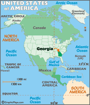
The state of Georgia is located in the southeastern United States. It is located on the continent of North America, and it is in the Northern (latitude) and Western (longitude) Hemispheres.
GSESS8G1.b Distinguish among the five geographic regions of Georgia in terms of location, climate, agriculture, and economic contribution.
The state of Georgia is divided into five geographic regions. In the north, there are three small mountainous regions, each with a differing topography. In the middle of the state is the hilly Piedmont area which is home to many of Georgia’s largest cities including Atlanta. Finally, the state is dominated by the Coastal Plain region, which takes up three-fifths of Georgia. The Coastal Plain, which is divided into an inner and outer section, was actually covered by water millions of years ago.
The Appalachian Plateau Region
-
Location: This region is located in northwest Georgia; known as the TAG corner (the region connects with Tennessee and Alabama).
-
Physical Characteristics: This region features flat or gently sloping land sitting above surrounding valleys.
-
Climate: The climate of this region has cooler temperatures due to its higher elevation (1800-2000 feet above sea level) and northern latitude. Summer temperatures can reach to the 80’s and occasionally the 90’s while during the winter months, temperatures span from the 20’s to the 40’s. During winter months, some snow (average of 5 inches per year) and ice cover the region.
-
Agriculture: Agriculture is limited due to poor soil. However, some corn and soybeans are produced in this region.
-
Economic Contributions: The most profitable industries in this region include tourism and forestry. The production of coal and limestone are productive as well. This region is the only known source of coal in the state.
-
Interesting features: Located in Georgia’s smallest region are Cloudland Canyon and Lookout Mountain. No significant rivers are located in the Appalachian Plateau region. Caving is a popular pastime; however, most caves are located on private property.
The Valley and Ridge Region (or Ridge and Valley Region)
-
Location: Located in northern Georgia, this region lies between the Appalachian Plateau region and the Blue Ridge region.
-
Physical Characteristics: Long, parallel ridges separated by wide, fertile valleys. While ridges can appear to be mountains, the ridges range in height from 700 to 1600 feet above sea level.
-
Climate: The climate is similar to that of the Appalachian Plateau region. The climate of this region has cooler temperatures due to its higher elevation and northern latitude. Summer temperatures can reach to the 80’s and occasionally the 90’s while during the winter months, temperatures span from the 20’s to the 40’s. During winter months, some snow and ice cover the region.
-
Agriculture: Approximately 4% of the valleys is farmed and used as pastures. Crops include corn, soybeans, wheat and cotton. Hardwood and pine timber is harvested as well.
-
Economic Contributions: Textiles and carpets are produced in this region. Some mining occurs as well.
-
Interesting features: Dalton, Georgia is the “carpet capital of the world.” Numerous caves are located in this region.
The Blue Ridge Region
-
Location: This region is located in the northeastern corner of Georgia.
-
Physical Characteristics: The Blue Ridge Mountains are the highest in the Appalachian Highlands (between 2000 and 5000 feet). Brasstown Bald (4784 feet above sea level), Georgia’s highest peak, is located in this region. The beginning of the Appalachian Trail is marked by Springer Mountain (3782 feet). The name of this region comes from the blue haze that seems to envelop the mountains.
-
Climate: Like the other regions with high elevation, the Blue Ridge region features cooler weather in the summer and winter months than the southern portion of the state. It is the region that has the highest precipitation rate at over 80 inches of rain per year. As a result, the major rivers, including the Chattahoochee and Savannah Rivers, originate in the Blue Ridge region.
-
Agriculture: Small farms, located in the region’s valleys, produce apples, corn, and vegetables. Pastures are home to large animals.
-
Economic Contributions: Historically, mining has been important to the economy of the region. Gold mining opportunities have encouraged tourists to enjoy the region. The harvesting of timber is profitable for the region.
-
Interesting features: Brasstown Bald, Georgia’s highest peak, and the beginning of the Appalachian Trail brings tourists to the region. Dahlonega, the home to the United States’ first gold rush, offers mining opportunities to willing tourists.
The Piedmont Region
-
Location: The Piedmont region is located in the central part of the state and occupies approximately 30% of the land in the state. The Appalachian Mountain regions (Appalachian Plateau, Valley and Ridge, and the Blue Ridge) are north of the Piedmont while the Fall Line separates the Piedmont from its southern neighbor, the Coastal Plain.
-
Physical Characteristics: The Piedmont is characterized by gently rolling hills. The term Piedmont means “foot of the hills”. Also, featured in this region are major rivers flowing toward the Coastal Plain. These rivers tend to be shallow and can feature waterfalls or rapids. Red clay, formed when water mixes with the iron rust, is a characteristic of this region.
-
Climate: This region’s climate can be steamy and hot in the summers and can deliver snow in the winters. Temperatures can reach into the 90’s in the summers and into the 20’s during the winter months.
-
Agriculture: This region is home to significant agricultural production. Crops produced include cotton, soybeans, and wheat. Poultry/eggs, hogs, and cattle/beef are products of this region.
-
Economic Contributions: Timber is harvested in the Piedmont region. This highly industrialized region is devoted to the production of a diverse type of products, including carpet milling, aircraft and automobile manufacturing, and poultry processing. While agriculture is still economically important in this region, animal products such as poultry, eggs, and beef are dominant.
-
Interesting features: The Piedmont region is the second largest in the state. This region features the urban cities of Atlanta, Columbus, Macon and Augusta among others. Tornadoes can exact destruction in this region.
The Coastal Plain Region
-
Location: The Coastal Plain region is the southernmost region in the state.
-
Physical Characteristics: This region, 60% of the state, can be divided into two regions: the Inner Coastal Plain and the Outer Coastal Plain. The Inner Coastal Plain (in the western part of the region) is the agricultural heartland of the state. The Outer Coastal Plain includes the coast of Georgia and the Okefenokee Swamp. Major rivers flow through this region to the Georgia coast or the Gulf of Mexico.
-
Climate: This region of Georgia is characterized by hot, steamy summers and cool winters. Snowfall and ice are less likely to occur in this region.
-
Agriculture: The Inner Coastal Plain features fertile soil that produces peanuts, peaches, soybeans, cotton, Vidalia onions, and pecans. Other row crops are grown as well. The Outer Coastal Plain is less fertile due to the sandy soil. However, pine trees are harvested. Some row crops are produced in this region in areas away from the coast.
-
Economic Contributions: The pulp and paper industry is prominent in this region. Commercial fishing and seafood processing occurs in coastal regions. Tourism and recreation is important to the barrier islands and coastal towns. The impact of agriculture on the state’s economy is critical. The deep-water ports of Savannah and Brunswick and the inland ports of Bainbridge and Columbus connect Georgia products with global markets.
-
Interesting features: The barrier islands protect mainland Georgia from hurricanes. In recent years, tornadoes have wreaked havoc on this region.
GSESS8G1.c Locate key physical features of Georgia and explain their importance; include the Fall Line, Okefenokee Swamp, Appalachian Mountains, Chattahoochee and Savannah Rivers, and barrier islands.
The Fall Line is a natural boundary (a wide zone) that separates the Piedmont and the Coastal Plain regions.
Due to the drop-off of the hilly Piedmont region into the flat Coastal Plain, the waterfalls found on the Fall Line cause many rivers in the area to be difficult to navigate. In the past, waterfalls offered sources of water to create power so many mills were eventually located on the fall line. In addition, many of Georgia’s most important cities such as Columbus, Macon, and Augusta are located on the fall line due to their location as the last navigable upstream points in the state. Early settlers off-loaded goods at these points and settled in the area, creating towns that developed into cities that populate the Fall Line region today.
The Okefenokee Swamp covers 700 square miles and is the largest freshwater swamp in North America.
Located in southeastern Georgia, the swamp can be found in four Georgia counties (Charlton, Ware, Brantley and Clinch). American Indians lived in the swamp dating back to periods before the Mississippian period. The Choctaw American Indians gave the swamp its name which means “land of the trembling earth”. The most famous American Indian tribe that lived in the swamp was the Seminole, who fought two wars against the United States in the Okefenokee area. White families began settling in the area in 1805. From 1910 until 1937, before Franklin Roosevelt established 80% of the Okefenokee as a wildlife refuge, the swamp was a major source of timber. The importance of the Okefenokee Swamp lies in its natural and human heritage. As one of the world’s largest intact fresh water ecosystems, the swamp provides habitats to threatened and endangered species. Those species, now protected by the federal government, include amphibians that are bio-indicators of global health. Over 600 plant species are found in this ecosystem. Another importance relates to human activity. Over 30 employees maintain this natural region to ensure that the 40,000 yearly visitors leave the habitat as natural as possible. Visitors to this region spend $64 million in the surrounding counties. While visitors are important to the local economy, the primary emphasis is the protection of the wildlife and habitat.
The Appalachian Mountains are located in north Georgia.
The southernmost point of the mountain range (that extends into the northeastern part of the United States) forms the high peaks found in the Appalachian Plateau, Valley and Ridge, and Blue Ridge regions of the state. In the southern states, these mountains are called the Blue Ridge due to the blue haze that appears around their peaks. Long ago, the Appalachians were some of the tallest mountains in the world, though millions of years of erosion have weathered them tremendously. Today, the highest peak in Georgia is Brasstown Bald, which has an elevation of over 4700 feet above sea level.
In comparison, the highest peak in the continental United States is Mt. Whitney that is almost 14,500 feet. The Appalachian Mountains are important because they lie in the path of moist, warm air currents from the Gulf of Mexico that produce high rainfall patterns in the spring and summer and frequent snowfalls in the winter. The high elevation of the region, combined with a solid rock foundation beneath the surface and higher rainfall/snowfall, affects the formation of Georgia’s major rivers and tributaries. Another importance is the tourism industry that has developed in the region due to the scenic terrain.
The Chattahoochee River begins it journey to the Gulf of Mexico in the Blue Ridge region of the state and forms part of the border between Alabama and Georgia. American Indians long used the river as a food and water source, as did Georgia’s European settlers. Due to the Fall Line, the Chattahoochee becomes difficult to navigate between the Piedmont and Coastal Plain regions, though river traffic was important during the 1800s from the Gulf of Mexico to the city of Columbus. Today, the Chattahoochee is used primarily as a water source for the millions of Georgians living in the Piedmont area, though the river is also used for industry and recreation as well. In recent years, the states of Florida and Alabama have sued Georgia due to its unrestricted rights over the use the river.
The Savannah River forms the border between Georgia and South Carolina. One of Georgia’s longest waterways, the Savannah River begins in Hart County, forms Lake Hartwell, and then flows to the Atlantic Ocean. The river has been a source of water, food, and transportation for thousands of years. American Indians lived around the river and Spanish explorer Hernando De Soto was the first European to cross it. James Oglethorpe chose a site 18 miles upriver to create Georgia’s first city, Savannah. Today, the river is navigable for over 200 miles between the city of Savannah and Augusta. In addition to shipping, the river is used as a major source of drinking water for Savannah and Augusta, to cool nuclear power plants in Georgia and South Carolina, and to generate hydroelectric power. Other uses include irrigation for agricultural crops and recreation.
The Barrier Islands, also known as the Sea Islands or Golden Isles, are a chain of sandy islands off the coastline of Georgia. These islands protect the mainland from wind and water erosion. There are 14 Barrier Islands off Georgia’s coast including Tybee, St. Simons, Jekyll, and Cumberland. Some of the islands, such as Cumberland, are wildlife refuges and are national or state parks. Others, like St. Simons, have been developed and three (Little Cumberland, Little St. Simons, and St. Catherine’s) are still privately owned. People have lived on these islands for thousands of years. American Indians lived on them and, in the 1500’s, the Spanish set up missions there. During the Colonial and Antebellum periods, plantations were developed on the islands to grow products such as rice and indigo. Today, the islands are mainly tourist and recreation destinations though the fishing and paper industries are still important economic enterprises.
SS8G1.d Analyze the importance of water in Georgia’s historical development and economic growth.
Historical Importance of Water in Georgia
Water sources in Georgia have historical significance. Much of Georgia’s boundaries are bodies of water. The Chattahoochee River, the Savannah River and the St. Mary’s River create natural boundaries for our state.
American Indians and early settlers depended on the rivers and streams for food and transportation. As farming increased in the state, water sources were necessary to adequately serve the crops. Rice production in the southeastern Coastal Plains provided the first staple crop. The ports of Savannah and Brunswick supported the concept of mercantilism as they exported and imported goods necessary for life in the colony.
Rivers were used to transport goods and people as the state’s population expanded into American Indian territory. Control of major rivers during the Civil War often determined economic success or failure. Steamboats moved people and goods to the head of navigation (the Fall Line). Man-made lakes (reservoirs), primarily located in the northern half of the state, have benefited flood control, hydroelectricity, and have provided recreational outlets for Georgians. Georgia ports, having suffered from the boll weevil’s devastating impact on cotton exports, have rebounded to be major ports on the Eastern seaboard. Legislation has been passed to protect Georgia’s waterways though pollution concerns still exist. Water wars with neighboring states, drought conditions and shifting courses of rivers create concerns for Georgia today.
Economic Growth and Water in Georgia
American Indians recognized the importance of rivers and streams to trade. These early cultures used the rivers to transport animal pelts and trinkets to other settlements for trade. Trading posts were established and, when the Europeans arrived, many settled in the areas of these posts.
Early settlers developed a rice trade and naval stores in coastal Georgia. When malarial waters pushed settlers inland, the rivers and streams were used to provide water to “King Cotton”, a phrase used before the Civil War to illustrate the economic and political importance of cotton. Before the arrival of the railroad, rivers were used to transport raw cotton to the coastal ports. Steamboats provided transportation for goods and passengers on Georgia.
Factories and mills were powered by the rushing waters of Piedmont Georgia; however, the Civil War strangled production as the Union and Confederate forces struggled for control of the rivers. Rebounding from the war, the rivers saw the rise, once again, of steamboats and the improvement of inland ports on the Chattahoochee River, increasing the economic value of the river. As the turn of the century occurred, river usage for trade was impacted by the rise of the automobile and the airplane. The negative impact of the boll weevil and cotton exports on the deepwater ports of Savannah and Brunswick almost devastated the ports.
Eventually, new businesses located near the ports and the resurgence of economic success was underway. Georgia’s ports saw men and women produce Liberty ships during World War II. The ports today are among the most successful of the Eastern seaboard ports. Reservoirs were built to aid businesses dependent on hydroelectricity and have provided recreational facilities for Georgians. Water scarcity in Georgia today due to drought impacts agricultural production.
*************EXTRA INFO*******************
Georgia’s rivers, streams and lakes are steeped in historical relevance and economic importance to the growth of Georgia. Rivers and streams flow from the rugged terrain of north Georgia to the flat lands of the coastal plains. The surface waters and underground aquifers have helped Georgia’s human population determine where to settle and how to effectively utilize the land.
Pre-historic American Indians used rivers and streams as an important part of their daily survival. Rivers provided essentials: food, an avenue of transportation, and a connection to their spiritual world. Evidence of their occupation remains in an occasional find of Clovis points (a prehistoric tool that looks like a spearhead which was used for hunting) and crude pottery found along rivers.
As Europeans began to migrate to the state, their settlement patterns developed around rivers and large streams. Established in 1735, the town of Augusta was located on the Savannah River in an effort to provide the Carolina colony with protection from the Spanish and American Indians. This location is where the river became difficult to navigate (the Fall Line). The rushing waters would ultimately power grist mills, saw mills, and, in the years just before the Civil War, textile mills. A large rice plantation culture developed in the southeastern part of Georgia, providing the colony’s first staple crop. The “rice rivers”, the Savannah, the Ogeechee, the Altamaha, the Satilla, and the St. Mary’s, produced 95% of total rice output in Georgia until just before the Civil War. It was during this time that boundaries were established - landowner’s personal property, parishes (counties) and colony – often delineated by a river or stream.
As the population moved further inland due to bouts with malarial waters, headright grants (land given to settlers during royal rule and early statehood), and land lotteries at the American Indians expense, rivers again saw the location of settlement. At the head of navigation on the Chattahoochee River, the town of Columbus was established in 1828. During the antebellum period, steamboats travelled the Chattahoochee, delivering cotton to markets. The southernmost river’s direct, unimpeded connection to the Gulf of Mexico allowed the markets along its path to grow. The northern part of the river saw the development of saw mills and grist mills near taverns and ferries.
After the invention of Whitney’s cotton gin, cotton production increased dramatically in the Piedmont and upper Coastal Plain. The production of cotton and corn for livestock cleared land, which led to the erosion of barren fields. Soil washed into the streams, and, over time, higher stream beds caused widespread flooding. This untamed agricultural practice continued until the 1920’s and the devastation of the boll weevil.
Control of the Chattahoochee River and Savannah River became a necessity during the Civil War. Each river generated power for factories that were important to the Confederacy. The Savannah River was blockaded by the Union forces which ultimately strangled the port of Savannah. When General Sherman’s army crossed the Chattahoochee near Atlanta, he moved his armies toward Savannah, crisscrossing the Ocmulgee, Oconee, and Ogeechee rivers. As Savannah was Georgia’s major port city, thousands of bales of cotton waiting to be shipped were confiscated by Union forces. By 1864, the factories and mills at Columbus and West Point were ordered to be destroyed.
After a recovery period from the destruction of war, steamboats began to travel again on Georgia’s rivers. However, cotton was no longer the only product transported on steamboats as Georgians began to diversify their production. Fertilizers and naval stores (lumber, railroad ties, rosin and turpentine) became prominent products produced and shipped on steamboats. Passenger steamboats were popular during the latter part of the 1800s until other methods of transportation (railroads, air travel) became more fashionable.
The decline of the use of steamboats did not sway Georgians from using rivers and streams, however. In the early 1900’s, as industrialization gained a foothold in the state, Georgia Power Company created large reservoirs (also known as impoundments) to cool coal-fired electrical plants and hydropower. The 1930’s New Deal program, the Tennessee Valley Authority (TVA), built additional reservoirs to control flooding and to provide jobs for Georgians during the Great Depression. These reservoirs were built primarily in the northern half of the state. The construction of dams by the U.S. Army Corps of Engineers began in the 1940’s and 1950’s to aid in navigation, flood control, and to produce hydropower. Impounding rivers continues to fragment the natural river system in the state, causing concern as to the benefits to the environmental costs and financial relevance. These lakes, however, have provided recreational facilities for Georgians.
As the boll weevil decimated cotton crops in Georgia, cotton exports plummeted and the ports suffered a serious economic downturn. The economic upheaval improved as major industries brought their operations to Savannah and Brunswick. Savannah Sugar Refinery (Dixie Crystals) and Union Bag (a Kraft paper mill) began the revitalization of the Savannah River. As World War II raged in Europe and the Pacific, the ports of Savannah and Brunswick constructed over 175 Liberty Ships to support the U.S. war effort. Brunswick was home to the Navy blimps that searched for German U-boats off the coast of the state. After the war, the Georgia Ports Authority was developed to bring economic revitalization and rapid expansion to Georgia’s deep water and inland ports. Many natural wetlands in southeast Georgia, including parts of the Okefenokee Swamp, were drained for the development of pine plantations and agriculture. Many of the forest products from this period were shipped from the Savannah and Brunswick ports. The Savannah port is currently a major container-operations facility and, as of 2015, is the fourth busiest container port in the United States. Other products shipped from this facility includes forest and solid wood products, steel, automobiles and farm equipment. The Brunswick port now exports and imports dry bulk commodities as well as shipments of automobiles. The inland ports of Bainbridge and Columbus feature barge facilities where dry commodities and liquid bulk commodities, such as petroleum products, petrochemicals and crude oil, are exported.
After the Great Depression and World War II, Georgians rebounded with the diversification of agricultural crops. Instead of “King Cotton”, Georgia farmers now depend on adequate water resources to produce peanuts, soybeans, blueberries, pecans and peaches.
In Georgia, few water pollution controls existed prior to 1960. Toxic chemicals were released into the water supply and drinking-water quality was not regulated. Seventy percent of municipal sewage entered Georgia’s rivers untreated. Georgia began to aggressively address these concerns through legislation that required an adherence to strict environmental law.
Georgia has serious water concerns. The state currently is facing water scarcity. As our water resources remain fairly constant, our population has exploded and has created a higher demand for water. This has led to “water wars” with the neighboring states of Alabama and Florida in a decades-long court fight over how to share regional water resources. This particular feud started in 2013 when Florida sued Georgia, claiming that metro Atlanta residents and southwest Georgia farmers hurt downstream aquatic species by using too much water. Alabama, concerned about water consumption in Georgia, has cautiously watched the legal actions of Georgia and Florida. As of February, 2017, the state of Georgia was victorious in a recommendation to the U.S. Supreme Court when a judicial official urged the Court to reject strict new water consumption limits that Georgia said would have struck a devastating blow to the state’s economy. While the decision by the Court is not final, Georgia has secured one more notch in the Tri-State water wars. Coupled with droughts, the economic impact on agriculture is devastating. Lack of available water also increases fire hazards, reduces water levels, and causes damage to wildlife and fish habitats. Over the years, the shifting water course of the Savannah River has caused litigation between the states of Georgia and South Carolina.
**********End of Extra Info...important information below********
SS8H1 a. Describe the characteristics of American Indians living in Georgia at the time of European contact; to include culture, food, weapons/tools, and shelter.
Though three prehistoric American Indian cultures (the Paleo, Archaic and Woodland) lived in southeastern North America before 800 CE, it was the Mississippian American Indians who were living in Georgia when the Europeans, specifically the Spanish, arrived in the mid-1500’s.
The Mississippians rose to dominance about 800 CE and organized themselves into a very complex “chiefdom” society. This structured hierarchical society was comprised by a small number of “elites” (the power holders) and the majority were “commoners” (the work force). The Mississippians created large towns near rivers that featured a central plaza, residential zones and defense structures (palisades, guard towers and moats). The focus of the plaza was the earthen mounds, dedicated to religious and social activity though some served as cemeteries. Thousands of families lived in these towns. One-room wattle and daub shelters (walls built of a network of interwoven sticks and covered with mud or clay) served as sleeping facilities as they usually spent their days in the open. A widespread trade network connected Mississippian towns. Trade with other towns consisted of raw materials as well as finished goods, including shell beads, pottery with abstract images, and stone tools. Early Mississippians practiced horticulture (garden cultivation) and eventually moved into large scale agriculture as their population swelled. Initially, maize (corn) was their dominant crop and they eventually added squash, sunflowers, pumpkins, and beans. Unlike today’s farmers, the Mississippians did not plant fields of individual crops. Instead, the fields were intermixed with a variety of plants. Tall corn stalks provided a shield against damaging sun rays for ground level crops.
Tobacco was planted for ritual usage. They did not abandon hunting and gathering, however. Using bows and arrows and chert (sedimentary rock) knives, bone evidence indicates that they hunted deer, rabbit, muskrat, beaver, raccoon, and turkey. Turtle and fish were also a part of their diet. They gathered seasonal fruits, including plums, grapes, blackberries, and raspberries as well as a variety of nuts. The Mississippians improved on the stone tools of previous cultures to use in hunting, farming, and human conflict. After interacting with the Spanish under Hernando DeSoto’s leadership in the mid-1500’s, many Mississippians succumbed to disease and the group eventually reorganized into the historic tribes of the Creek and the Cherokee.